Digital Terrain Models
Obtain detailed digital terrain model (DTM) renderings of specified locations to streamline mapping and surveying projects.
Streamline Infrastructure Planning with Advanced Digital Terrain Modeling Services
Obtain detailed digital terrain model (DTM) renderings of specified locations to streamline mapping and surveying projects. The professionals at TOPS offer advanced DTM services to create a precise representation of the Earth’s surface to facilitate an informed planning stage for roads, railways, and other infrastructure. We successfully integrate cutting-edge technology within our workflow, ensuring our ability to tackle your unique project demands.
Call us at 623-323-8441 to speak directly with a member of our team.
Request A Free Quote
Understanding Digital Terrain Data
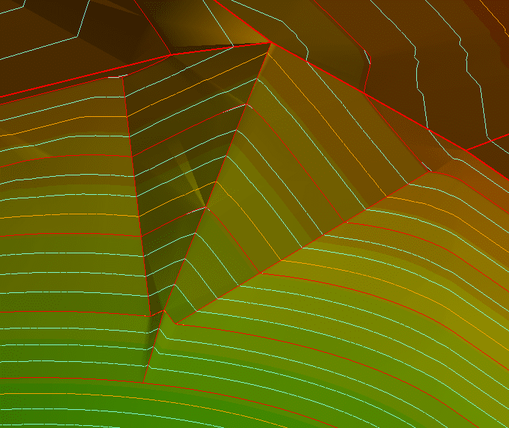
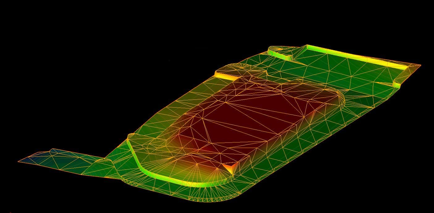
Digital terrain modeling is the process of generating an accurate illustration of the Earth’s surface, often referred to as a “bare-earth extraction.” Many believe DTMs are an augmentation of Digital Elevation Models (DEMs), which focus on elevation, including man-made structures and vegetation. However, DTMs are 3D models comprising vector data sets with X, Y and Z coordinates to describe the height and elevation of natural surface features like ridges, ridge lines, rivers, valleys and mountains.
The accurate terrain data that this modeling process requires is typically collected using remote sensing technologies and photographic strategies, including LiDAR and photogrammetry. Once collected, it is imported into specialized software to digitize contour lines and efficiently remove noise, errors and unwanted topographical features. This digital process offers unrivaled benefits to facilitate informed decision-making procedures within various applications and industries, including:
- Natural resource management
- Disaster risk assessments
- Urban planning
- Land development
- Military mission planning
The Process of Digital Terrain Modeling
Whether you’re working on an urban planning project or researching climate change, digital terrain modeling holds the key to a deeper understanding of the world around us. The first step in developing these representations includes creating a project scope and determining the information you seek from your model. These guidelines will help you figure out what technologies to use and what calculations you’ll need to obtain high-quality information, leading to a more intelligent and efficient workflow.
Capture
Accurate elevation data is required before generating high-quality DTMs. Data collection is crucial to inform your model creation, offering precise measurements and facilitating meaningful calculations to learn more about your job site or region. This capture process can take shape in multiple ways, depending on your demands and project scope. Ground surveying and remote sensing using LiDAR or photogrammetry technologies often provide the ideal balance between efficiency and accuracy.
LiDAR collection relies on intelligent equipment like terrestrial and airborne collection units, while photogrammetry employs drones and digital imaging equipment. These systems provide current, information to give your project the best chance at success.
Preprocessing and Construction
Preparing your topographic data for model construction involves various tasks to ensure it is in the best condition possible. Datasets are first imported into highly intelligent software such as ArcGIS, ENVI, TerraScan or Trimble Inpho. Which software we use will often depend on the type of collection strategy we wish to utilize.
One of the biggest tasks of preprocessing is data cleaning to remove extraneous information collected during the capture stage. This includes eliminating the presence of vegetation and artificial structures to obtain a clear interpretation of the ground. It’s also crucial to establish a consistent datum since it’s likely that you’re working with data collected from various angles and perspectives.
Triangulation and interpolation are additional steps you should take to minimize irregularities in your data and fill in the gaps while preserving critical features. Using methods like triangulated irregular networks and inverse distance weighting enables the creation of a cohesive data set ready for interpretation.
Land Surface Calculations
Once you have a suitable DTM set up, it is time to extract measurements to determine how your project will move forward. Basic land surface parameters are derived from these calculations and can infer a lot about a local or regional area. Common calculations include slope, aspect, curvature, elevation profiles and visibility analysis. Uncovering these details will fuel integral analyses to plan communication networks, understand ecological patterns and inform the proper design of your infrastructure projects.

Ready to discuss your project?

Benefits of Digital Terrain Modeling
Digital terrain modeling is a useful strategy that benefits professionals operating within numerous industries, including surveying, engineering, land management and more. They provide accurate insight into their understanding of the terrain with regard to characteristics like elevation and other natural features. However, this process offers engineers, surveyors, and construction specialists more than just intricate visualizations. Digital modeling offers unrivaled advantages to an array of operations, including:
- Improved decision-making: Digital models are highly informative representations of land areas that are otherwise too large to investigate efficiently and precisely. Our work provides engineers with a better understanding of the landscape to identify potential challenges and ensure a successful project outcome.
- Vast range of applications: Developing DTMs is a straightforward process of creating location-specific models that you can leverage within various situations, from understanding water flow to identifying potential risks of land use applications. They’re produced quickly and easily and can be manipulated to become a practical solution to satisfy the unique project demands across diverse industries.
- Enhanced precision: Digital terrain modeling gives professionals an in-depth view of a specific area’s surface characteristics. Using high-performance technologies and software to capture and produce these invisible-to-the-eye features enables greater accuracy in its results.
- Optimized workflow speed: Learning more about the land using digital collection methods creates dense datasets that often require time and energy to work through. DTMs make sense of this complex information by creating a user-friendly 3D visualization that will decrease time spent in the field.
Why Choose Our Digital Terrain Modeling Service
When you are looking for reliable DTM services, TOPS is your go-to provider to achieve all your objectives. We leverage our more than 30 years of industry experience to deliver exceptional data processing solutions. We’ve been focused on developing a cohesive end-to-end precision terrain mapping service, ready to address your specific concerns and propel your project toward success. We strive to become a trusted member of your team to decrease the load on your shoulders and uncover your path to an easier way to generate detailed models.
Our cutting-edge team of licensed surveyors, engineers and 3D technicians have unrivaled expertise, and we approach every project with strict attention to detail and unparalleled dedication to creating the best possible takeoffs. Leveraging the latest technology and software, we regularly work on over 1,000 projects per year, in every size and scope. This volume positions our organization as the most active in the industry, giving our team the unique insight to produce exceptional value that drives a productive workflow.
Three Simple Steps to Begin Your Project
To get started with TOPS, you just need to follow three easy steps:

Step 1: CAD Files
Provide the CAD files for the project in formats like AutoCAD .DXF and .DWG, among others. Files can be uploaded to their FTP site or shipped with the paper plans.

Step 2: Paper Plans
If sending paper plans, they will scan and store them electronically. You can transmit the scans or ship the paper plans.
Step 3: Work Order
Fill out a data prep work order on their website with the details of your scope of work. TOPS can accommodate various needs; just specify how you want the job to look.
We have no association with any manufacturer or system type but provide 3D models for all manufacturers
Get in Touch With Our Team to Learn More
Working with TOPS is the best choice to keep your surveying and mapping projects on track. We strive to provide a valuable service to our clients, ensuring a seamless partnership that simplifies your operation. The only documents our experts need are your CAD files, paper plans and work orders before getting started on a high-quality DTM that provides information you can trust. We work quickly and can often send you an email with your models within 48 hours when needed.
The professionals at TOPS are ready to supply precision terrain mapping services to offer more topographical insight across your site. You can reach out to our team online or give us a call to learn more about our services today.


