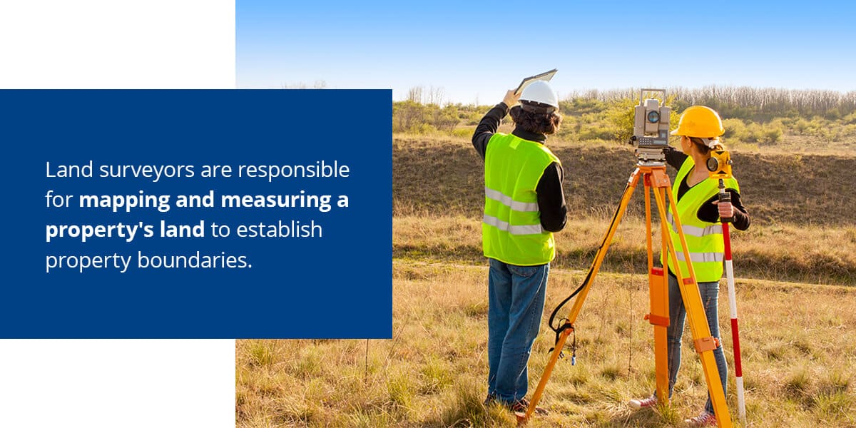
When civil engineers first plan to develop a property, they require land surveyors to provide accurate measurements and information about the land. As a result, land surveyors are critical to civil engineers who want to do their job properly. By working closely with land surveyors, civil engineers can increase their project’s safety, improve efficiency and ensure they comply with various standards.
Find out more about what land surveyors do and how these professionals assist civil engineering projects.
Exploring the Role of Land Surveyors in Civil Projects
Whenever an individual or company purchases a property to develop it, land surveyors play an essential role. Land surveyors are responsible for mapping and measuring a property’s land to establish property boundaries. They also provide information about the property’s topography and existing buildings or improvements. Surveyors can give clients precise measurements and data about a property, and they’re regularly employed for construction, engineering and mapmaking projects.
Given land surveyors’ expertise in determining topographic heights, land sizes and land measurements, they regularly advise the work of other professionals. For example, they often guide the work of geologists, developers, town planners, architects and engineers. You can even see them in governmental roles, helping sewer, power and water authorities receive the information they need to do their jobs well.
You’ll typically find land surveyors conducting measurements at the beginning of a development or construction project. They make their measurements, map the land and give this information to architects, who use it to design their projects with the landscape in mind. Land surveyors also provide their measurements to engineers, who use the data to ensure any planned structures are safe.
Boost Your Civil Engineering Project with Precision
Build on the strength of accurate data from land surveyors with TOPS. Our experienced team, driven by precision and dedication, creates 3D data to enhance site work, machine control, and layout, setting your earthworks project up for success.
The Synergy of Surveying and Civil Engineering Expertise
While public works, such as public education facilities or health care institutions, are some of the most common civil engineering projects, you can also find civil engineers helping organizations build bridges, pipelines and canals. Since civil engineering often requires structures and other infrastructure to be placed on top of the environment, land surveyors play an important role.
Infrastructure needs to be safe and fit the land it’s built on, so civil engineers need accurate land surveys before they begin their work. A land surveyor provides engineers the data they need to ensure their project doesn’t negatively affect protected environments. They also give engineers the measurements and information they require to ensure any structure they build will be safe. Land surveyors can even help engineers ensure their project has peak efficiency.
To support a civil engineering project, a surveyor will look for several land qualities. For example, they’ll often note the nature of the land, such as if it’s grassy, rocky, clear, forested, flat or uneven. They’ll also collect data about the angles and distance between critical points and measure relative elevations.
Information on natural features, such as rivers and hills, are other types of data included in land surveys for civil engineers. A land surveyor will also include data on human construction, such as power lines and roads. If a civil engineering project requires a map, land surveyors can produce it.
Once a project ends, civil engineers require an as-built survey from a land surveyor. This survey is meant to determine how accurate the initial survey’s data was after the project’s completion. The land surveyor will create a new survey designed to check that the earlier measurements match various details and positions of the final project. Civil engineers require surveyors to repeatedly survey a structure to ensure it’s safe and has the appropriate technical performance.

Critical Contributions of Land Surveying to Civil Engineering
One of the biggest reasons civil engineering projects need land surveyors is that they provide accurate data engineers can use in their proposals. Land surveyors are also important because they can conduct inspections in high-risk areas and help resolve legal disputes. Learn more about the importance of land surveyors and some of the essential ways they aid civil engineering projects:

Enabling Precise Proposals with Detailed Survey Data
As civil engineering organizations create proposals, they need accurate data. When a civil engineering organization submits its proposal, it often needs to gain public support — whether through lawmakers voting on the project or the public directly voting for it. If a project appears dangerous, it can sink, leading the public or lawmakers to vote against it.
Accurate data helps engineers create a proposal that shows the infrastructure will be as safe as possible. For example, a land surveyor might use a 3D simulation via drone survey to show how a structure will impact the environment. If the survey reveals a new road could lead to erosion in the surrounding area or impact water flow, civil engineers can adjust their proposal to account for these potential dangers.
With accurate data in their corner, engineers can prepare more detailed proposals. These detailed proposals help lawmakers who want the project to pass, as they can more easily showcase how safe the project will be in the future and how it will change the current environment. Since safety is a huge public concern, civil engineering firms may find it difficult to get public lawmakers on board with a project until they prove it doesn’t come with high risk.
Performing Specialized Inspections in High-Risk Zones
When civil engineers need to work on high-risk projects, such as bridges, they often turn to land surveyors. Surveyors usually have the equipment required to safely assess a project site without putting staff in danger. For example, a land surveyor can use a drone to assess high-risk areas that people can’t easily or safely access. Using a drone is much safer and can deliver more detailed results, as it can navigate around complex terrain or structures and gain a bird’s-eye view of a property.
Since civil engineers play a major role in creating or repairing high-risk projects, such as dams, canals and bridges, they need highly accurate data to ensure they don’t put the public in danger. If a dam breaks or a bridge crumbles, it can lead to injury and death. A land surveyor can conduct a survey before and after a project to ensure civil engineers have the necessary data to build safe structures.
Clarifying Property Legalities: The Surveyor’s Role in Dispute Resolution
Sometimes, civil engineering projects face disputes over private and public property. A private landowner may believe the project crosses over to their property, while the civil engineering firm may believe their project only goes over public land. When there’s a dispute about property lines, land surveyors can help to resolve it. Usually, a land surveyor will conduct a boundary survey to establish whose land the civil engineering company is developing their project on.
A land surveyor will often use a drone to conduct these boundary surveys, as they can establish property lines faster. With a bird’s-eye view of the property lines and the use of other surveying technology, they can quickly find where private land stops and public land starts. A land surveyor may also use LiDAR scanning and UAV technology to ensure their surveys are as accurate as possible.
By using advanced technology to complete their boundary survey, a land surveyor can quickly resolve legal problems and stop delays from occurring. These surveys can also increase public support in the project, as people will know the civil engineering project is only using public land.
Identifying the Right Time to Engage a Land Surveyor
When you plan to develop a piece of land, you’ll need a land surveyor. Since you’ll need to comply with your project’s end goal, building goals and local regulations, a land survey is an essential part of development. With a land survey, you’ll gain a better understanding of the site’s topography and dimensions, giving you critical data to ensure your project doesn’t run into compliance issues.
One of the most important times to use a land surveyor is when you’re planning to change the land’s use. In this case, you might need a planning permit. Part of attaining this permit involves receiving approval from a local government, where they’ll check overlays, land zoning, municipal strategic statements and permitted land uses. A land survey is often required to ensure your project meets the aforementioned permit requirements.
Land surveys are also necessary when a project has different zoning requirements on a site. For example, a piece of land may have various overlays on it, such as protections for vegetation, wildlife or heritage. You might find that land has different local provisions, such as plot ratios and building heights. With these various zoning and land requirements, land surveys are essential. These surveys give you data about topographic heights and land that is critical for addressing zoning requirements.
Another time you’ll need a land surveyor is when you’re working on a sloped site. Since a land surveyor can use specialized equipment to measure horizontal distance, they can assist civil engineers who might not have equipment capable of making these measurements. You can also rely on surveyors to measure vertical distance. These measurements are critical when your project requires you to excavate a pipeline or build a drain or road.
Essentially, any time you need to know exactly how a project will fit on a piece of land, a land survey is needed. Whether you’re constructing a new bridge or upgrading a road, land surveys allow you to know how your planned structures will fit with the land and ensure your project won’t cause safety issues.

Partner with Take-off Professionals for Advanced 3D Surveying Solutions
Many civil engineering firms and organizations rely on the benefits of land surveyors to improve their projects with the following:
- Increased boundary accuracy: One of the many land surveying benefits is helping civil engineers establish accurate boundaries for a piece of land. With the right property boundaries established, a civil engineering team can better plan out construction and development. Accurate boundaries also help teams avoid legal disputes with people who own land near their project, saving time and raising public satisfaction with a project.
- Greater understanding of topography: Before civil engineers begin a project on a piece of property, they need to know its topographical details. A land survey ensures engineers have a better understanding of topography, such as determining if the land has any structural or soil issues or if it is prone to flooding. By gaining a greater understanding of a plot’s topography, the civil engineering team can determine if their project is feasible and safe before they begin development.
- Better property division: When a civil engineering firm makes their proposals to local authorities, they need to ensure they’re not building on private property. A land survey gives them better property division by clearly showing where public property starts and ends.
- Improved construction preparation: Before a civil engineer OKs construction, a land survey can give them various data about the plot. This land survey’s data can help civil engineers ensure any structures are placed in the ideal location and that any necessary preparation has been completed prior to construction. With this data, a civil engineer can provide their construction team more accurate plans and help them better prepare for construction.
- More accurate value estimation: Land surveyors can also help civil engineers and other professionals determine how much a piece of property is worth. By having a detailed land survey, you can more accurately value a property based on its landscape, hardscape and location details.
Choose Take-off Professionals for Your 3D Data Needs
At Take-off Professionals, we understand the need for accurate data from land surveyors for the success of any civil engineering project. After receiving data from surveyors, our experienced engineering team creates 3D data to assist with site work, machine control and layout. Alongside our engineers, we also employ surveyors and 3D techs to ensure any models we provide are extremely accurate and give you the information you require to ensure a project is safe and can be completed as efficiently as possible.
Take a moment to learn more about our data prep services today. If you have any questions, contact us or request a free quote.


