Profitable Implementation of Civil Integrated Management
The recent advances in technology for use in civil construction are impressive. The broad appeal of GPS, LIDAR, lasers, total stations and computers have provided the contractor with many opportunities. Contractors have embraced these advances but not without...
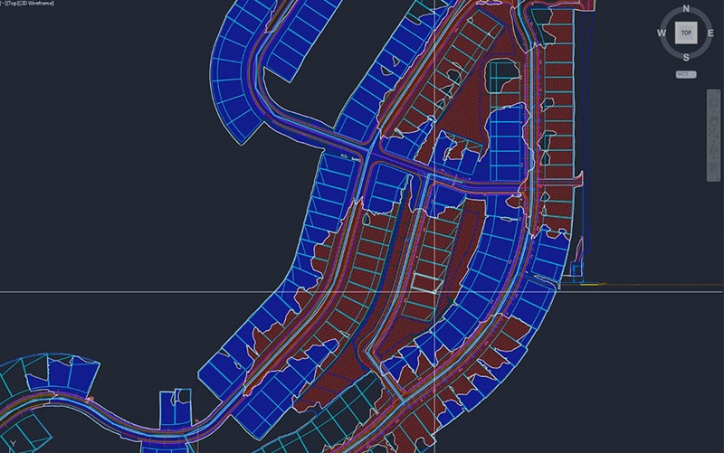
Choosing Between 2D and 3D Site Models for Construction
Modeling is essential in the construction industry for planning projects, communicating ideas and ensuring work gets done correctly. Construction professionals have used two-dimensional (2D) site plans for these purposes for some time, but more recently,...

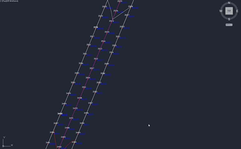
The ABC’s of XYZ (Points)
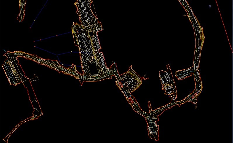
At one time the only way to lay something out on a jobsite was to locate a point in 3-dimensions. With the advent of having real time/location elevations from a surface model, points have become less frequent on the jobsite. There are three major uses for points on a...
Maximizing Road Subgrade Efficiency with GPS Technology
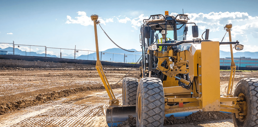
When spring rolls around, road construction gets into full swing. Road contractors have been early adopters of technology and continue to drive the development of new applications and equipment. Among them are laser augmentation for vertical accuracy and the...

Advancing Construction: The Role of Civil Surveying
Civil surveying is essential for the success of many construction projects, from residential and commercial buildings to infrastructure. It gives project managers and engineers the geographical information they need to build a structure that will stand up reliably in...
Working with Surveyors
Many years ago, I proposed that machine control would change the surveyor’s role and made it a point to discuss this with many state surveying groups. As a rule, surveyors need to be exact. A circumstance could come up where one would have to defend their work in...
Regarding Civil Site Takeoffs
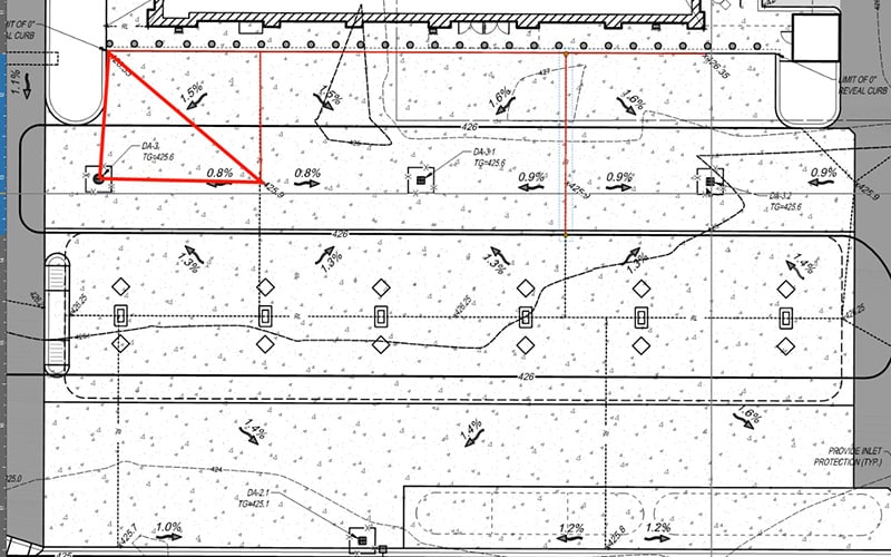
The request for “a quick takeoff” means different things to different clients. When a client makes this request, I generally know exactly what they need. The quick dirt number I provide usually leads them to knowing how much Teflon tape they’ll need for the water pipe...

Optimizing Land Surveying: The Drone Advantage
Surveying is a profession that requires patience and accuracy. Companies across many industries need surveyors to evaluate large plots of land and provide them with detailed mapping and measurements. From construction crews to archaeologists, having an aerial view or...
Paving Rehab Data
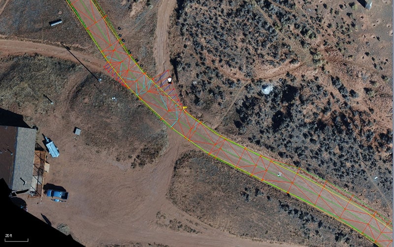
The U.S. Interstate Highway system is almost complete. Regional networks are mature, and the new right of way is geared for housing. Luckily, we still see new alignments and the percentage is increasing for repaving and full reconstruction. This increase has led us to...

Navigating the Horizon: Innovations in Surveying Technology
From the ancient wonders of the world to the modern buildings we inhabit today, surveying technology has been helping us measure for thousands of years. We've come a long way from the rope stretchers of ancient Egypt, but land surveying technology is still evolving....