Aerial and Land Surveyors
Maximize Construction Efficiency with Expert Aerial and Land Survey Data Processing
Aerial and land surveys collect vital information about a site that can guide construction and other processes. To use this data most effectively, you need an expert company that can process it and turn it into models, takeoff estimates and other helpful information.
With a team of experts in the construction and modeling industry, Take-off Professionals is ready to provide processing services for your aerial and land surveys. We can help you determine what’s on the land so you can plan more effectively and use your resources more productively.
Call us at 623-323-8441 to speak directly with a member of our team.
Request A Free Quote
Our Proficiency in the Aerial and Land Surveying Industry
Our company began in 1988 with the mission of providing support and technology for busy contractors. Throughout our years in the industry, we have continually adapted and grown our services to face new and changing requirements. We use a mix of advanced technology and specialized skills to turn aerial and land surveying data into practical models.
Here are a few ways we stand out in the aerial and land surveying industry:
- Knowledge: Our team members have spent their careers in construction and have specialized knowledge of the modeling process.
- Technology: We utilize a suite of the latest technological solutions, such as computer-aided drawing (CAD) and building information modeling (BIM), to create tailored solutions.
- Accuracy: You can expect high attention to detail in our planning process. We’ll fix issues within your models before they translate into problems in the building process.
By blending aerial and land survey data into our models, we provide an efficient process to help you move to the next project stage. Our models can incorporate multiple data points. Better accuracy and efficiency mean savings on everything from material costs to labor.
Services for Aerial and Land Surveying Projects
Our expertise in the aerial and land surveying industry means we can use your data for various applications, from residential building projects to highway construction. Through our data and processing services, we’ll create practical resources and models you can use effectively in the field.
Aerial Surveying Services
Aerial surveying involves using aircraft, drones and satellites to collect data from above using photography or light detection and ranging (LiDAR). This surveying process creates a large-scale view that’s ideal for hazardous terrain or expansive sites. Aerial surveying can provide high-resolution imaging for everything from urban planning to infrastructure development.
Whatever your reason for doing aerial surveys, we can analyze your data. We perform services like LiDAR modeling and aerial photogrammetry to turn data into detailed models.
Land Surveying Services
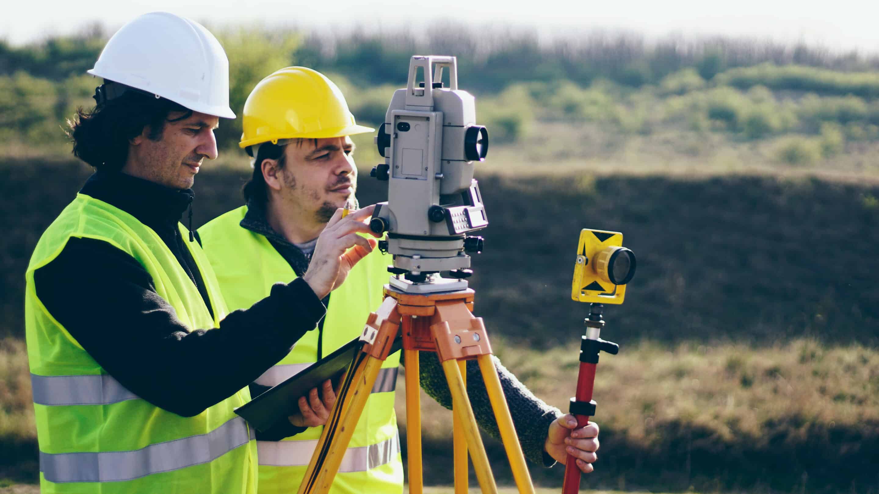
While aerial surveying collects data from above, land surveying involves total stations, GPS receivers and levels used on the ground. These instruments can collect information about elevations and positions to provide accurate measurements and assist with construction layout. This on-the-ground information serves construction projects of various sizes.
We can use your land surveying data to create topographic or construction surveys. Our teams will tailor their data prep services to your needs and data collection method.
Integrated Services
Some projects benefit from a mix of land surveying and LiDAR data collected through aerial methods. Our integrated services combine your data into one usable set we can transform into accurate models for any purpose on your jobsite.
Why Partner With Us for Your Aerial and Land Surveying Projects?
Beyond bringing specialized expertise for aerial and land surveying modeling, TOPS provides various advantages that make us your best choice for data preparation services.
Rather than subcontracting work, we have a team of full-time employees who are dedicated to serving your business. Our only focus is data. By sticking to this core competency, we can offer the best quality for whatever service you need, from machine control to layout.
Our team works on about 1,000 machine control models annually, and we provide national coverage through engineers who work across three time zones. We can work on your schedule and answer questions during your workday to keep projects moving. We also take on a variety of projects, serving you for everything from custom home lots to highway building. Come to us for any need, large or small.
Our specialized online platform gives you added convenience throughout the data prep process. You can upload your files and add notes and relevant information to your account. We also use email automation to keep you up to date on our progress.
Discover Our Data Processing Services for Aerial and Land Surveying
Whether you work in the aerial or land surveying industries, the data you collect is valuable. Our team uses takeoff and 3D modeling services to prepare that data for future use.
Takeoff
Construction takeoffs allow you to determine the necessary material amounts for a project. Our quantity takeoff services enable you to estimate accurate project costs, giving you more control throughout the building process.
We can take your aerial or land surveying data and prepare assessments, including material quantities and a detailed earthmoving strategy. Takeoffs give you the necessary information to make successful bids and complete projects.


3D Modeling Services
Our 3D modeling services involve using your surveying data to create models of your jobsite. You can use 3D modeling in land surveying for machine control applications, such as positioning buckets and blades to achieve the desired grade during earthmoving.
These services apply to various tasks, including paving, dozing and excavating. Detailed 3D models also support site work and layout requirements.
Request a Free Quote
We support the aerial and land surveying industries through data preparation services. Our engineers, surveyors and 3D techs will take your survey data and use advanced technology to create models and takeoff calculations. You can leverage our services to work more efficiently and get high-quality data that enhances every project stage.
Learn more about what we can do for you by contacting us online for a quote.